Products Overview

Explore our GIS platform across five focused product categories for teams, developers, and end users.

Thematic and Analytical Visualization

Thematic & Analytical Visualization

Heatmaps, choropleths, clusters, and layered visual analytics for operational decision-making.

Remote Sensing Imagery Layers

Remote Sensing Imagery Layers

Satellite and aerial imagery integration for change detection, land monitoring, and terrain context.

Sensor and Field Data Ingestion

Sensor & Field Data Ingestion

Ingest IoT, GPS, and field telemetry streams into map layers for real-time monitoring workflows.

Address and Place Search

Address & Place Search

Autocomplete search across addresses, POIs, and local place datasets.

Reverse Geocoding

Reverse Geocoding

Convert coordinates to structured addresses with locality and context metadata.

Tracking and Geofencing

Tracking & Geofencing

Live trip tracking and geofence events for fleet supervision and route compliance.

Remote Sensing Analytics

Remote Sensing Analytics

Image-based change detection and feature extraction for infrastructure, environment, and land monitoring.

AI Location Intelligence Dashboard

AI-driven Location Intelligence Dashboard

Comprehensive dashboard with AI-powered insights and analytics.

Global Geospatial Infrastructure

Global Geospatial Infrastructure Stack

Scalable global infrastructure for worldwide geospatial services.

High-availability Map Hosting

High-availability Map Hosting

99.9% uptime map hosting with global CDN and redundancy.

SDK and Developer Tooling

SDK & Developer Tooling

Production SDKs, integration utilities, and documentation for fast enterprise implementation.

Security and Data Sovereignty

Security & Data Sovereignty

Encryption, access control, and deployment options for regulated and sovereign environments.

Sensor and Event Stream Platform

Sensor & Event Stream Platform

Stream GPS, IoT, and external events into geospatial APIs and monitoring workflows.

Consumer and Fleet Tracking

Consumer & Fleet Tracking

Live movement tracking, trip playback, and safety visibility for personal and business mobility.

Delivery and Field Optimization

Delivery & Field Optimization

Dispatch planning, route execution, and field operations optimization at scale.

Agriculture and Land Monitoring

Agriculture & Land Monitoring

Topography and remote-sensing intelligence for crop health, land use, and terrain conditions.

Platform Spotlight

The Fastest, Most Flexible GIS Platform

Goldits delivers real-time mapping, analytics, and secure offline routing with unmatched performance and control across cloud, edge, and air-gapped deployments.

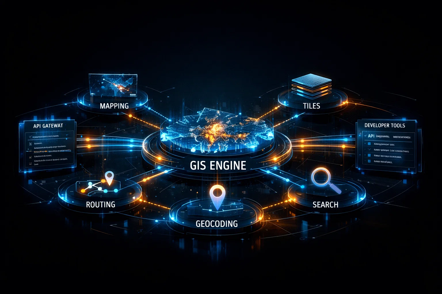
Engineered for high-scale geospatial workloads

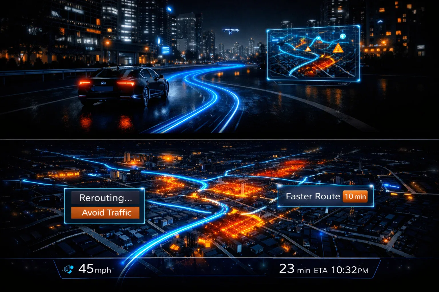
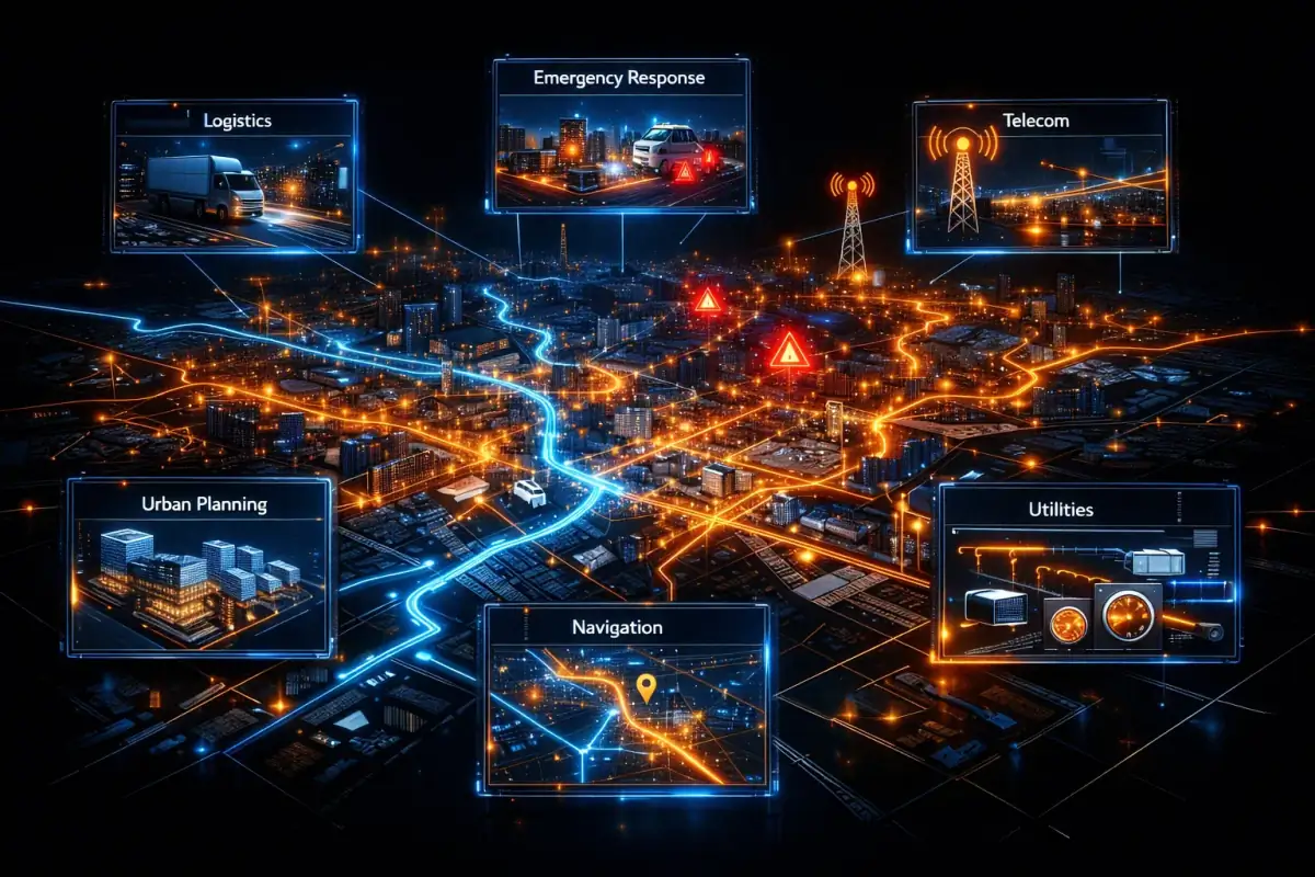
From nationwide map delivery to mission-critical field routing, one unified stack powers rendering, search, routing, and analytics without platform lock-in.

  • Sub-secondMap interactions
  • Online + OfflineEdge-ready deployment
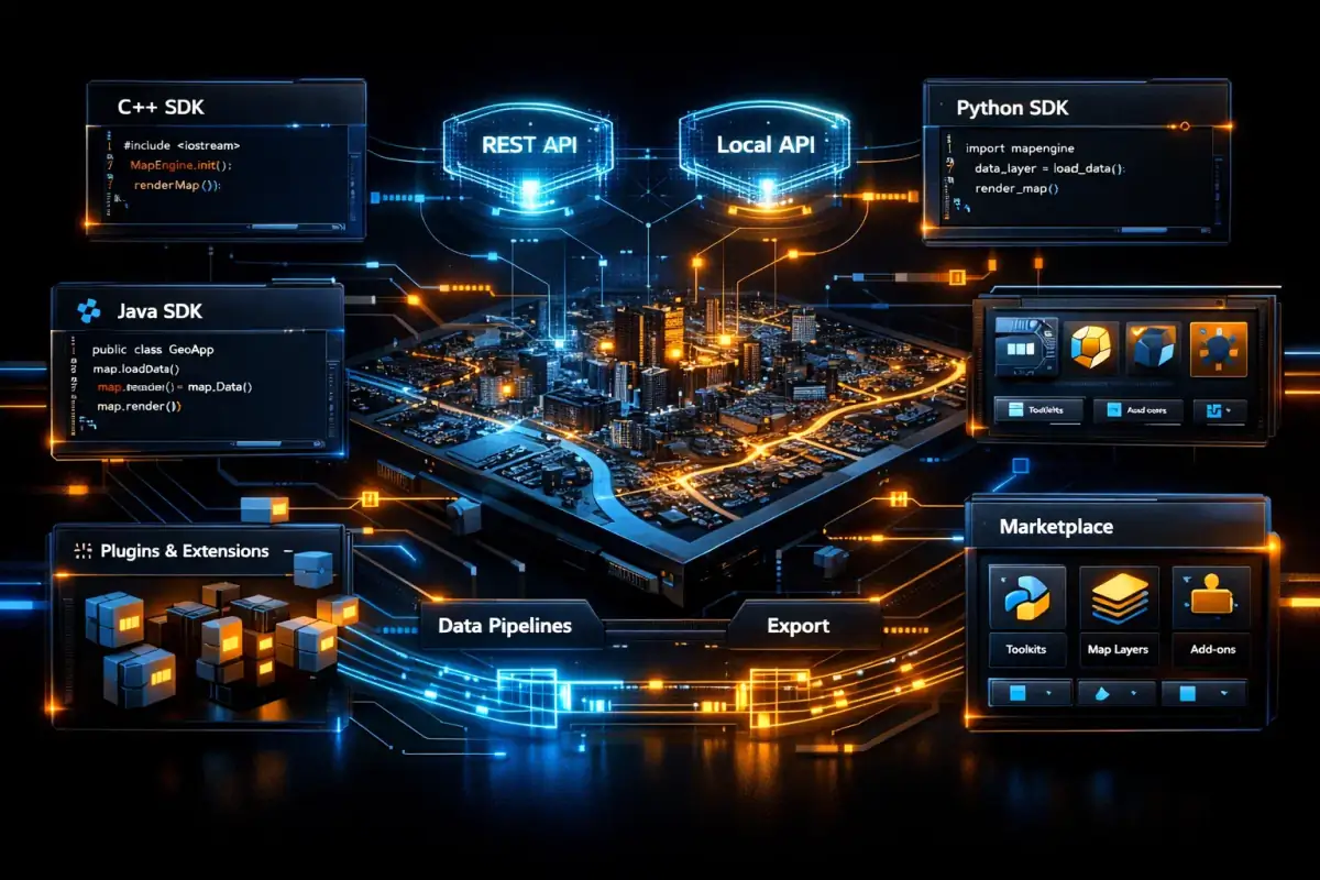
  • API-firstDeveloper integrations
Real-time GIS platform rendering

Real-Time Mapping

High-fidelity rendering with dynamic layers, updates, and smooth multi-scale interaction.

Topography & Sensing

Terrain models, remote imagery, and sensor streams combined for high-context geospatial operations.

Routing Precision

Multi-modal routing with live traffic, ETA, and optimized path generation.

Tracking & Operations

Live telemetry, geofence events, and monitoring dashboards for dispatch and field control.

Research

Insights, whitepapers, benchmarks, and architecture notes on Goldits' geospatial stack. First item will be published soon.